


")

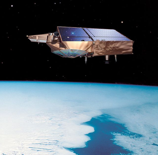
The European Space Agency (ESA) agreed to launch a copy of its lost Cryosat Satellite to definitively measure the effect of climate change on Earth’s ever-changing ice sheets.
The first Cryosat Ice mission was launched last October from the Plesetsk Cosmodrome in northern Russia, but was lost when the second stage of its launcher failed to separate. The rocket plunged into the ocean with Cryosat aboard. Cryosat chief scientist Duncan Wingham, however, was undaunted, rallying his supporters behind his firm conviction that “Cryosat is too important to lose.”
Wingham lobbied for funding and on February 24 the ESA Programme Board agreed to provide over one hundred million euro to launch Cryosat-2, a satellite that will measure and monitor the health of land and sea ice worldwide.
Cryosat-2 could launch in as little as three years on a mission to help explain the complex relationships between the polar ice, the rise in sea levels, and climate change. Cryosat-2 is the first in a series of missions called Earth Explorers, part of ESA’s Living Planet Program to launch low cost spacecraft to help us to understand the Earth, and our impact on it.
CHECK OUT: Scientists Confirm Victory in Ozone Layer Recovery
Another mission will launch this year to accurately map the world’s gravitational fields. While gravity feels constant to people, Earth’s gravitational field actually varies widely from place to place. The Gravity (GOCE) Earth Explorer will provide an accurate map to help explain the effects of gravity on ocean currents that regulate the climate from place to place, keeping Europe warm and Antarctica cold, for example. Goce will also be able to effectively monitor sea level rise, and the effects of gravity on surface water flow, helping us to predict climate changes and the need for sea barriers and levees. (Photo credit: ESA)