")


")


Tuesday was the 3,000th day, or “Sol,” during which NASA’s Curiosity Rover has been trundling about on the surface of the Red Planet.
The images the rover has beamed back have colored in the dreams of thousands of Star Wars, Star Trek, and John Carter fans, and our understanding of what the closest, potentially habitable planet looks like has grown with each photo.
Making landfall on Aug 6, 2012, Curiosity proceeded to begin its six-year ascent up the side of Mount Sharp, a three-mile high mountain.
Still climbing after all this time, it stopped on Nov 18, 2020 to use the mast camera and take a series of 122 images over the mission’s 2,946th sol. Stitched together, they form a wide-angle shot of Gale Crater, a 96-mile-wide bowl which Mount Sharp sits within.
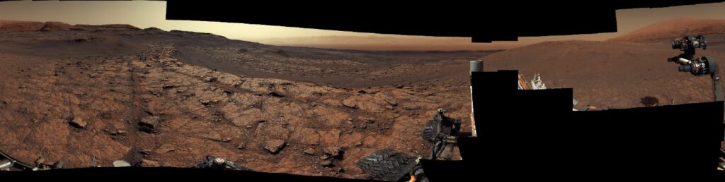
A press release from NASA describes the geology of the Mount Sharp panorama: “the curved rock terraces that define the area can form when there are harder and softer layers of rock on a slope. As the softer layers erode, the harder layers form small cliffs, leaving behind the benchlike formations”.
“Our science team is excited to figure out how they formed and what they mean for the ancient environment within Gale,” said Curiosity’s builder and managing scientist, Ashwin Vasavada of NASA’s Jet Propulsion Laboratory in Southern California.
It’s just one of many discoveries the Curiosity Rover has made, and will continue to make as it rambles about, millions of miles away from home.
NASA’s Curiosity Mars rover spotted this dust devil with one of its Navigation Cameras around 11:35 a.m. local Mars time on August 9, 2020.
CHECK OUT: Australia Blows Science’s Collective Mind by Mapping 3 Million Galaxies in 300 Hours
To celebrate its three-thousandth day on Earth, here is a photographic journey of the rover’s six-year climb up the side of Mount Sharp, all the while encountering giant sand dunes, fascinating geology, captivating rock formations, dust storms, and more.
2015: A view from the “Kimberley” formation on Mars, taken on the 580th Martian day, or sol, of the mission.
2015: This composite image looks toward the higher regions of Mount Sharp.
2016: The dark band in the lower portion of this Martian scene is part of the “Bagnold Dunes” dune field lining the northwestern edge of Mount Sharp, inside Gale Crater.
2016: Butte ‘M9a’ in ‘Murray Buttes’.
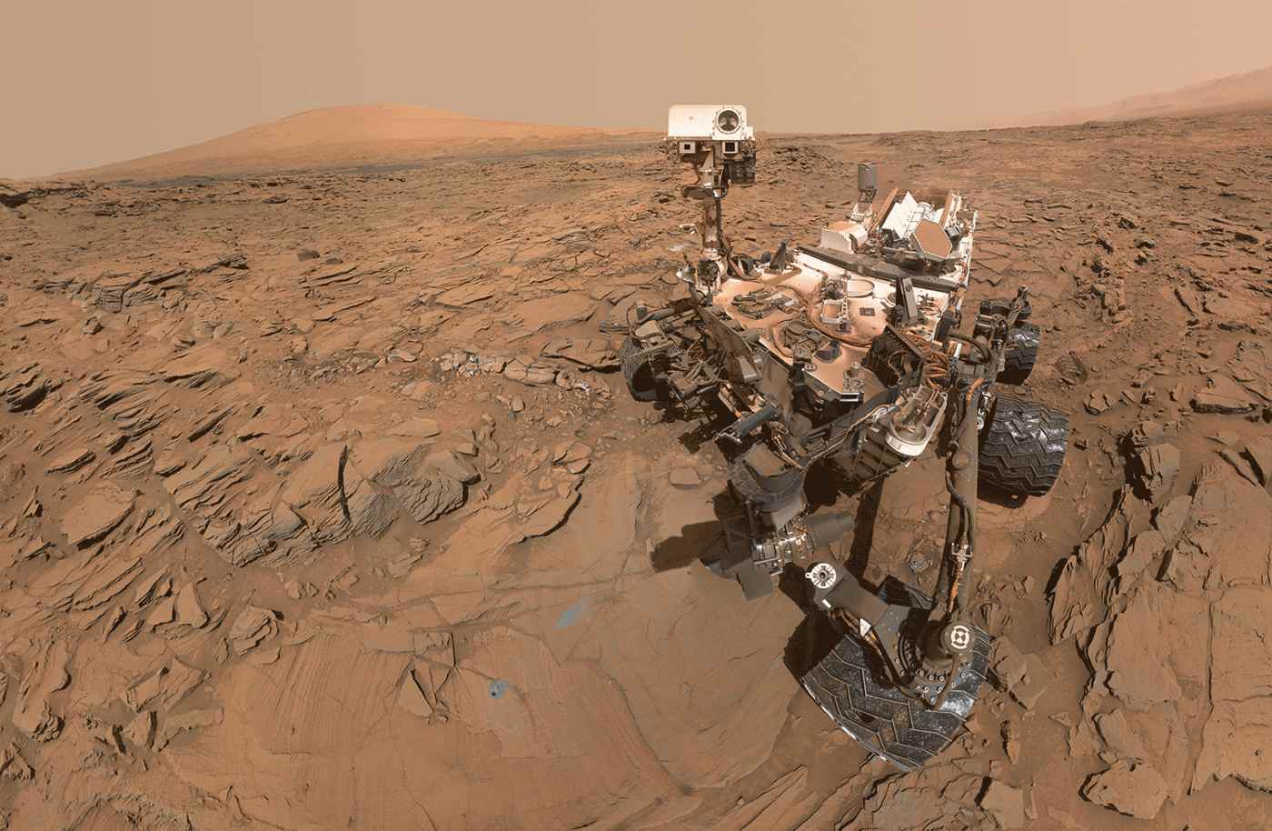
2016: This animated image blinks two versions of a selfie of the Curiosity Mars rover at a drilled sample site called “Okoruso.”
2017: This dark mound, called “Ireson Hill,” rises about 16 feet (5 meters) above redder layered outcrop material of the Murray formation on lower Mount Sharp.
2018: This mosaic taken by the rover looks uphill at Mount Sharp, which Curiosity has been climbing. Spanning the center of the image is an area with clay-bearing rocks that scientists are eager to explore.
2018: Telephoto vista from Vera Rubin Ridge in Gale Crater.
2019: 360-degree panorama of a location called “Teal Ridge.”
2019: The rover imaged these drifting clouds on the 2,405th Martian day, or sol, of the mission, using its black-and-white Navigation Cameras
2020: Stitched together from 28 images, this view shows part of a geologic feature called “Greenheugh Pediment.”
SHARE These Far-Out Photos From NASA With Your Planet-Loving Pals on Social Media…