













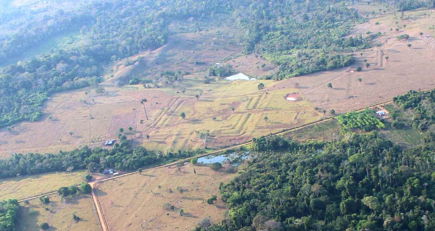
Hundreds of geometric earthworks were recently found in the southwestern Amazon, evidence that a monument-building, precolonial civilization was so much larger than previously thought.
The scale of this hidden world of massive earthen construction projects only began to truly be understood this decade, but a recent aerial survey using laser radar has dramatically increased the footprint of this civilization.
It may indeed be larger than anything yet known in the region, with the total body of evidence showing a greater concentration of these structures in just 3% of the Amazon than in the other 97%.
The paper, published last week in Nature saw Martti Pärssinen, at the Ibero-American Institute of Finland carry out surveys over an area of 4,497 km2 in the southwestern Amazon in concert with his colleagues from Finland and Brazil.
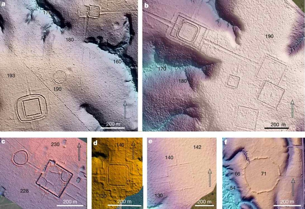
They used LiDAR, an acronym for “Light Detection and Ranging.” This technology fires a laser which moves through the jungle canopy and down to the ground before rebounding back up to the plane like sonar. It allows researchers to accurately map in fine detail what lies below the canopy, and has contributed to many seismic archaeological discoveries in the Amazon Rainforest over the last two decades.
Their dataset yielded 432 separate earthworks, of which 396 were previously undocumented, around the cities of Rio Branco, Lábrea, Boca do Acre, and Carauari. By extrapolating these results, and in combination with existing satellite studies, the authors suggest the region may contain far more of these earthworks—between 24,000–30,000.
Their builders are referred to as the Aquiry civilization, and are known almost exclusively because of their large geometric ditched enclosures, known as Amazonian geoglyphs. It’s assumed they functioned as ceremonial, political and public gathering centers.
The mostly solitary structures are composed of ditches and embankments and range from 0.35 to 14 hectares in size; the largest known geoglyph covers nearly 123 acres. They first began building the geoglyphs around 2,500 years ago, while either themselves or a successor society continued building and using them, albeit with alterations in style, to as late a date as the 13th century.
Aquiry life is believed to have reached its greatest scale and wealth between the 1st and 4th centuries of our common era.
ANCIENT CIVILIZATIONS: A ‘Stonehenge Prototype’ Aligned with the Solstices Is a Once in a Lifetime Find for These Archaeologists
A previous population estimate for the Aquiry considered how many people would have been needed to build and maintain the earthworks, and considered 60,000 to be an accurate assessment using the data of the time—when only 200 of the earthworks were known, but that number has increased by orders of magnitude with new evidence.
“On the basis of both existing data and our LiDAR documentation, we show that this cultural area alone contains as many earthworks as previously estimated for the whole of Amazonia,” the authors wrote. “We also propose that the total human population of the area in 100–300 [CE] was 1.25–3 million people.”
1 to 3 million people, at roughly the same time period, would put the Aquiry civilization on par demographically with the Late Preclassical Maya societies from as far north as the northern Yucatan Peninsula to as far south as Belize, making Aquiry one of the largest groups in the Americas at the time.
OTHER MAJOR LIDAR DISCOVERIES: Hundreds of Mayan Cities and Towns with Ball Courts and Roads Discovered in LiDAR Survey in Guatemala
Additionally, 28,000 earthworks would make the Aquiry region not so much smaller than the Maya Lowlands as well.
“By using airborne LiDAR technology, it has been possible to triple the area of the Aquiry civilization from the earlier 60,000 km2 to approximately 183,000 km2,” the authors summarized.
The study is a massive leap forward in the understanding of the Aquiry. Just take a look on Wikipedia and see how much information is available on them.
SHARE LiDAR Striking Archaeological Gold In The Amazon Once Again…
These lidar images are fascinating.
” .. Preclassical Mayan societies …”
The people are “Maya,” the language family is “Mayan.”