


")


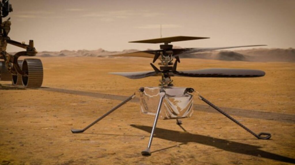
The little helicopter that the Perseverance rover brought along to Mars has repaid its big brother for the tagalong—snapping aerial images of the Red Planet the rover can then use to help its journey across the Jezero Crater.
Having performed the first ever rotary flight on Mars earlier this year, NASA’s Ingenuity Helicopter is now on its ninth flight—and on July 5th, it revealed details about the over-and-underlying geography of Mars that will be crucial to completing the rover’s mission.
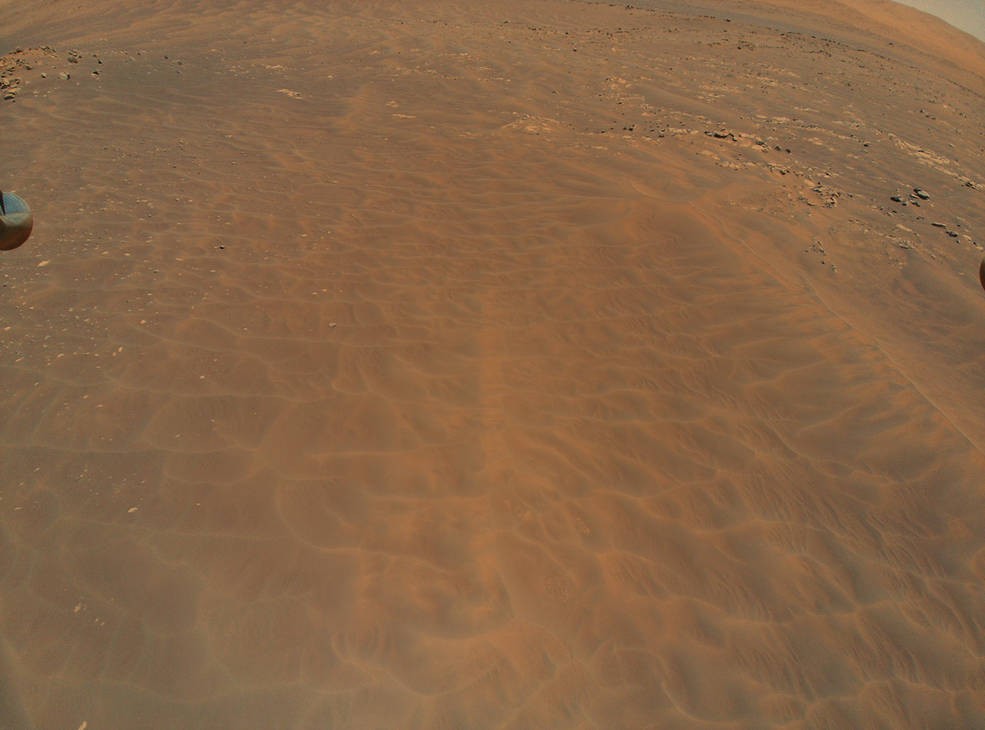
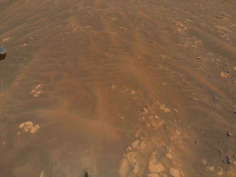
During its recent two-minutes and forty-six seconds in the air, the helicopter quadrupled its own record for distance covered, and also broke records for cruising speed and time as it moved over an area called Séítah—which will be difficult for a rover like Perseverance to navigate due to the soft sand there.
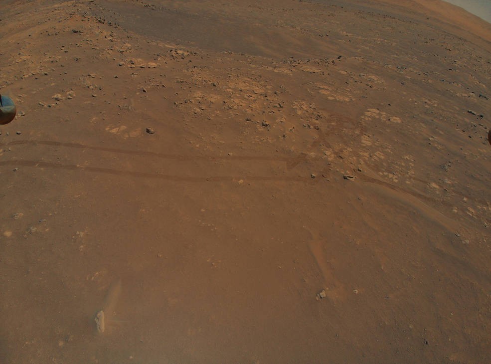
It also snapped amazing images of rippling sand, shadows, rock, and other Utah-like terrain features.
“We’re hoping the color images will provide the closest look yet at ‘Pilot Pinnacle’, a location featuring outcrops that some team members think may record some of the deepest water environments in old Lake Jezero,” wrote Ingenuity team members on the project website.
Indeed this most recent flight, and the photos that took three days to be beamed back and processed, revealed some high-value science targets like the so-called Raised Ridges that NASA scientists believe could be the key to finding remains of ancient life in a lakebed that’s billions of years old.
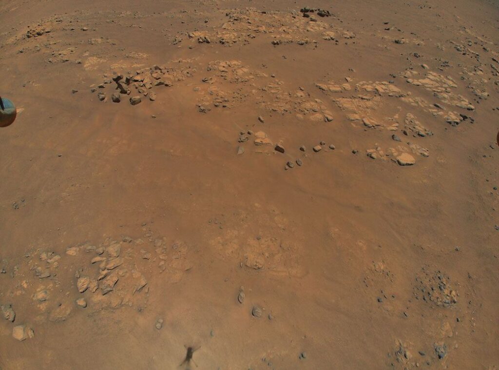
“Spying the ridges in images from Mars orbiters, scientists have wondered whether water might have flowed through these fractures at some point, dissolving minerals that could help feed ancient microbial colonies,” write NASA.
Other areas found during Flight 9 include open sand dunes of which Perseverance must avoid at all costs—or risk getting stuck—and images of Martian bedrock, which looks like an interesting feature to be later checked out by the rover.
CHECK OUT: NASA Image Shows the Spectacular Beauty of the Milky Way’s ‘Downtown’
“Our current plan is to visit Raised Ridges and investigate it close up,” Perseverance Deputy Project Scientist Ken Williford said. “The helicopter’s images are by far better in resolution than the orbital ones we were using. Studying these will allow us to ensure that visiting these ridges is important to the team.” That’s an important detail when the mission’s schedule is tight and power resources are limited.
SHARE These Far-Out Photos With Pals on Social Media…
After thought hitchhiker tucked in nicely to the underbelly of the main project, evolves into a able bodied
sidekick. Ingenuity’s initial thirty second hover check, is now far beyond its proof of concept. Well done!