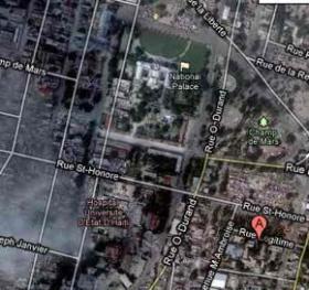
 A group of college students is helping rescuers on the ground find their way around the wreckage in Haiti by pointing out roads and obstacles among the destruction. But they’re doing it all from the comfort of their classroom, using current satellite images and a program called “Open Street Maps.”
University of Nevada Cartography students are digitizing pictures of roads and waterways, and then detailing the maps with things like collapsed buildings, road obstructions, and spontaneous camps that have sprouted up to help rescue workers in Haiti.
(Continue reading in KOLO-TV)


