


")

Staggering images taken from planes using forest-penetrating radar are mapping the geology of Washington state.
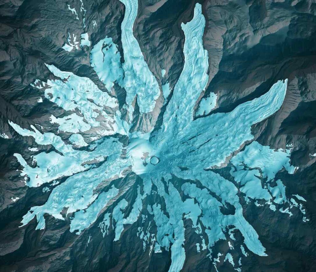
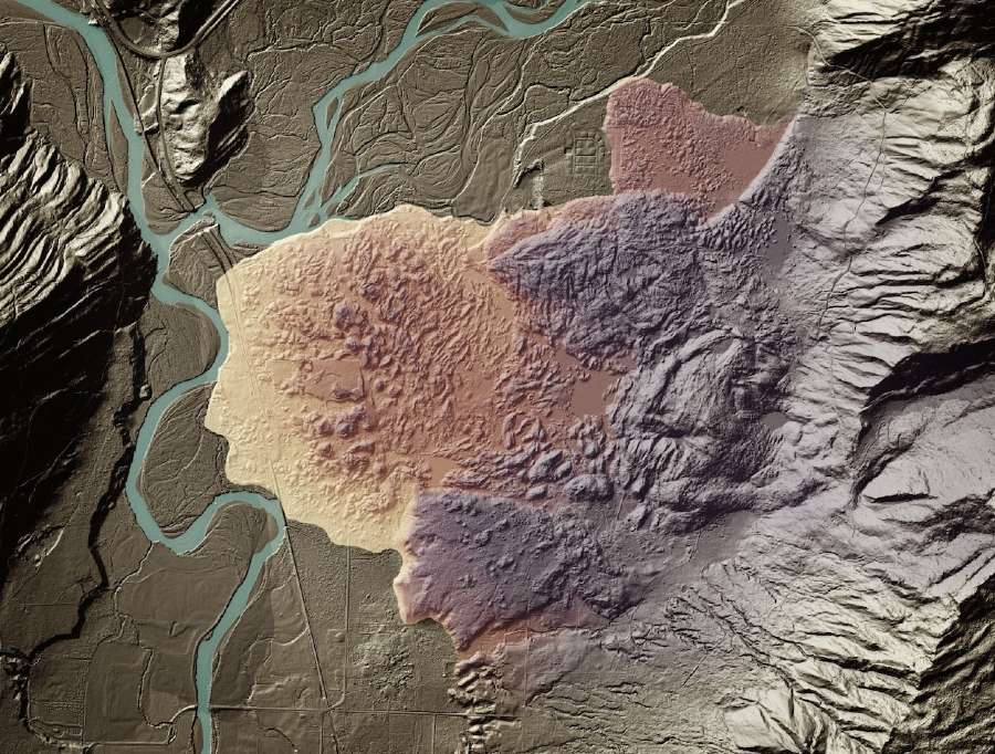
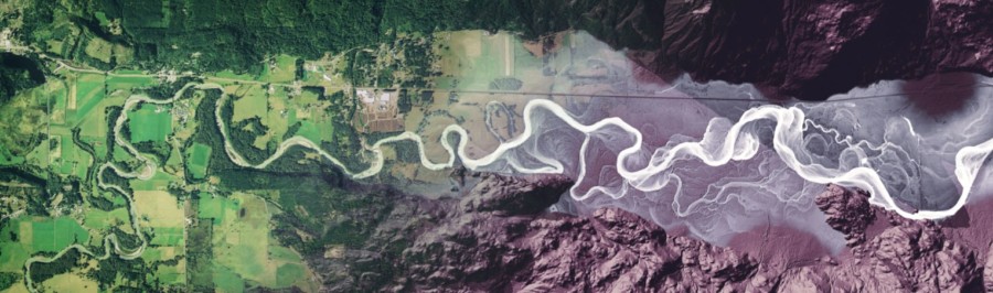
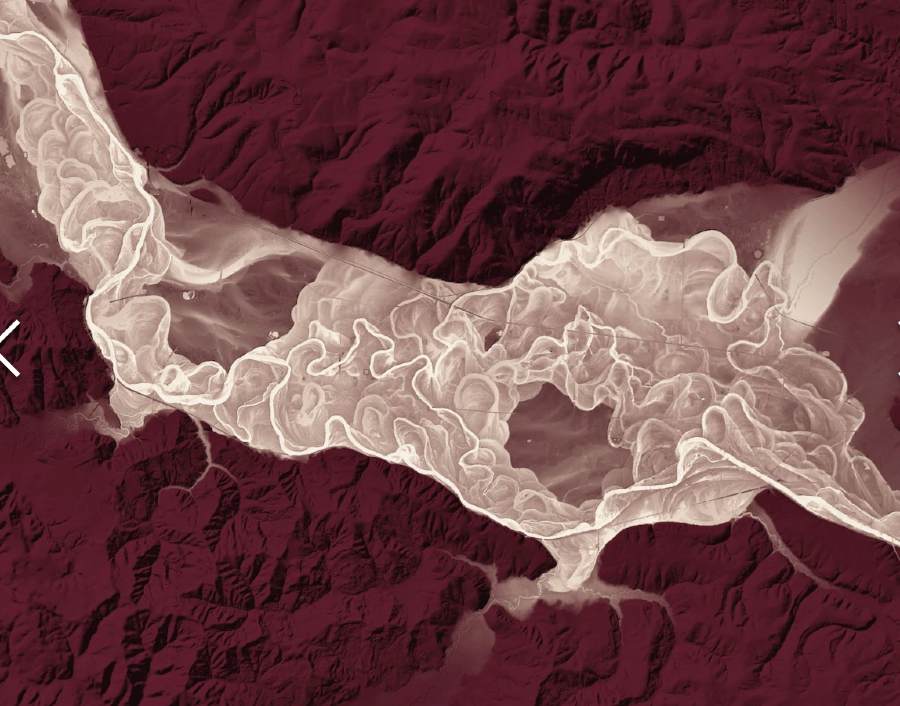
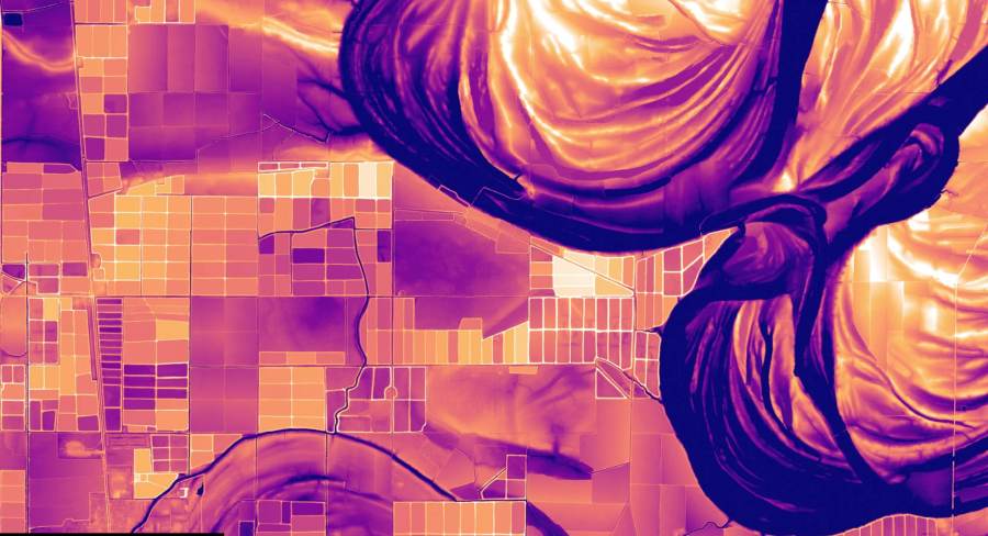
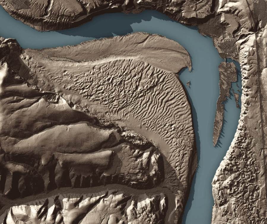
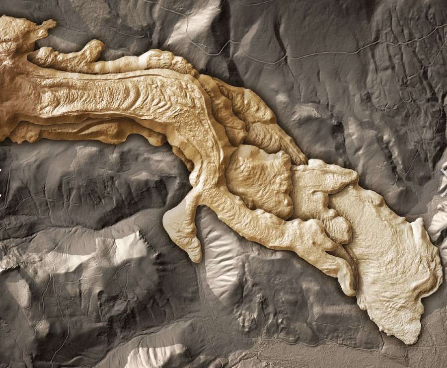
Intriguing, artsy, beautiful, and outright bizarre, “The Bare Earth” presentation on the Washington state Department of Natural Resources (DNR) website uses shading and added color to present underlying geological features like lava flows, glacial moraines, drumlins, tsunami inundation, mudslides, eruptions, fault lines, river patterns, and much, much more.
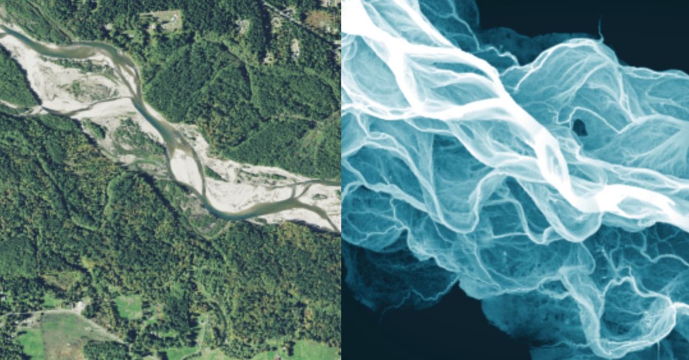
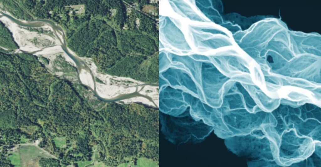
LIDAR, which stands for Light, Detection and Ranging, is a laser-guided mapping system that fire billions of laser pulses at an object, and like sonar or radar, gathers information about the object as the beams return.
The information in this case is the time it takes each pulse to arrive back.
MORE: After Decades of Work, Scientists Have Mapped the Entire Surface of the Moon for the First Time
Some of the light is reflected off the tree tops, but enough will reach the ground below to reveal the underlying geography as if the trees simply didn’t exist.
The light also penetrates the soil strata, meaning that while the first reading of the return pulse indicates the surface topography, the final return pulse is the bare earth below, giving unparalleled pictures of the landscape.
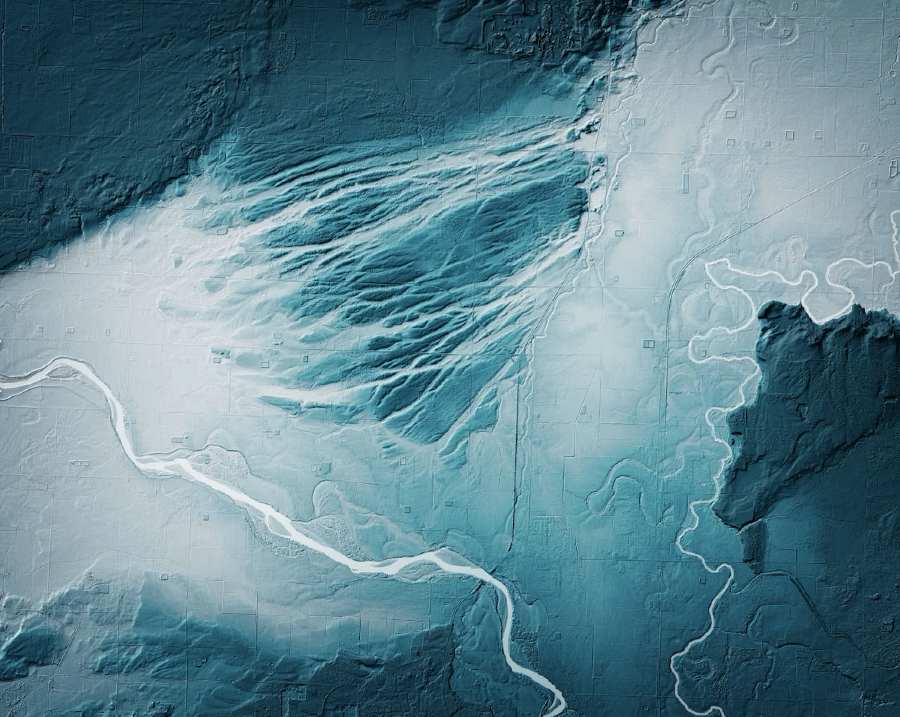
This technology was used to produce a fascinating series of images by a cartographer at the U.S. Geological Survey of the Mississippi.
LIDAR revealed hundreds of years of subtle changes in flow, flooding, and bending of the mighty river.

Following a deadly landslide in 2014 that destroyed parts of a small town about 50 miles outside of Seattle, the Washington Geological Survey realized it would behoove them to map out potential landslide sites to provide early warning for people living there.
As it turned out, the same method of discovery geological and climatic hazards using LIDAR can help state authorities plan for all manner of emergencies, such as volcanic eruptions, tsunamis, earthquakes, and more.
RELATED: Map Lets You See How Your Hometown has Moved Across 750 Million Years of Continental Drift
The Bare Earth presentation records all the findings LIDAR has made in a state that has a seriously varied geomorphology—the change and evolution of the surface and underlying geology over time.
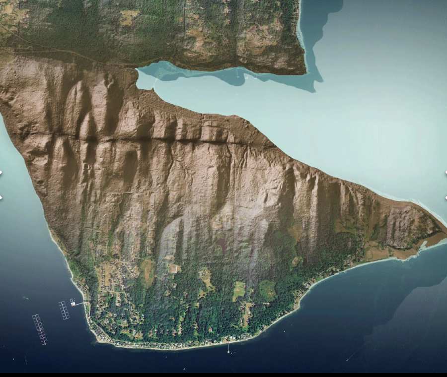
It records the use of LIDAR to map the state’s landslides, geological curiosities, bedrock, fault lines, tsunami reach and erosion, volcanoes, glaciers, and riverways.
You’ll definitely want to spend a little time looking over the images.
SHARE the Stunning Images Online With Friends…