


")

LiDAR has done it again: pyramids, a ballcourt, and columns built by the late Mayan Empire over 1,000 years ago were discovered under the forest canopy thanks to the hi-tech surveying device.
The site is located in the largely-unexplored forested region in the Mexican state of Campeche, an area of 1,150 square miles near the Calakmul Biosphere Reserve.
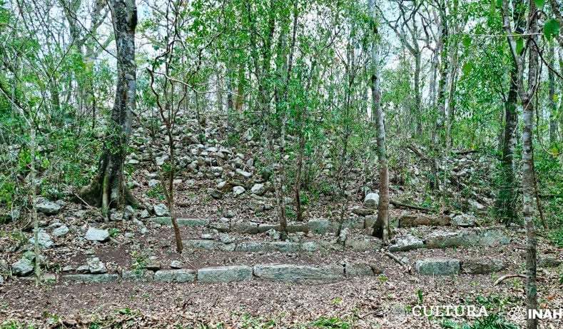
Named Ocomtún, the word for ‘column’ in the Yucatec Mayan language, the city’s nucleus stretches for 123 acres centered around a stone pyramid.
Several plazas, a ballgame court, and the stone columns that gave Ocomtún its name surround the pyramid, all believed to be built between 250 CE and 1,000 CE.
“The site served as an important center at the regional level, probably during the Classic period,” said Ivan Šprajc, an anthropologist at the Research Center of the Slovenian Academy of Sciences and Arts, who participated in the survey project alongside several Mexican institutions.
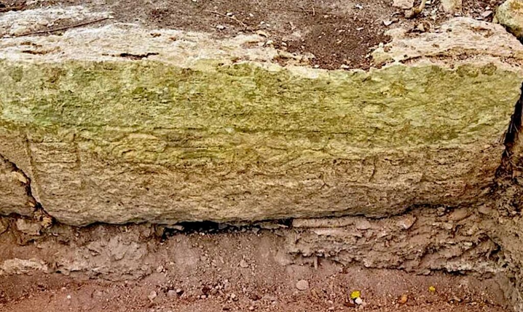
“The most common ceramic types that we collected on the surface and in some test pits are from the Late Classic (600-800 CE); however, the analysis of samples of this material will offer us more reliable data on the sequences of occupation”, detailed the doctor in anthropology.
The discovery began with LiDAR surveys in March of 2023, revealing multiple prehispanic structures in an area bigger than Luxembourg.
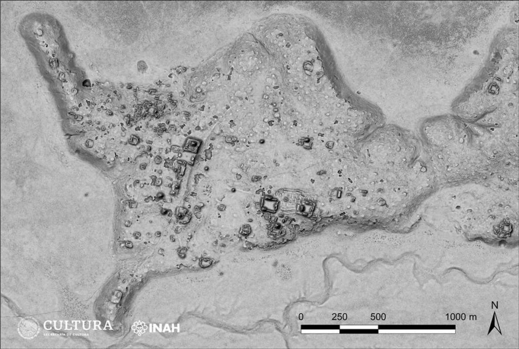
Abbreviating “light detection and ranging,” LiDAR is a laser-survey device that can make detailed maps of the terrain underneath the jungle canopy. Mounted on the front of an aircraft, LiDAR can survey in exquisite detail even if it’s flying at high speeds.
MORE MESOAMERICAN ARCHAEOLOGY: Over 100 New Nazca Lines Discovered in Peru Designed by Ancient People
The technology has done so much more than just show archaeologists where to look and dig under South and Central America’s rainforest canopy, it is legitimately re-writing the history of human civilization and placing Meso-america’s people at levels of organization and technological sophistication that surpass that of post-Rome Europe.
For example, thousands of miles south in Bolivia, LiDAR discovered a lost South American civilization called the Casarabe Culture, who built large pyramids, sophisticated irrigation, and road infrastructure, but they did it all with dirt.
“Just imagine you are working 20 years in that region like we did, and you have to explain to someone not familiar with the archaeology of the region, and they’re asking what is special about that culture—you’d need an hour to explain it,” Dr. Heiko Prümers who led the LiDAR survey, told World at Large. “Now we just show the images, and everybody will say ‘wow, yes it’s obvious that it’s something big’”.
MORE ARCHAEOLOGY NEWS: Divers Are About to Pull a 3,000-Year-Old Shipwreck From the Depths
Other big discoveries include Angamuco, a major urban settlement of the Purépecha civilization, now in ruins hidden under vegetation, in the Lake Pátzcuaro Basin of Michoacán, Mexico. It contained an estimated 39,000 buildings spread across an area about 40% the size of Manhattan.
Despite being in a pretty densely populated area, it remained undiscovered until 2007-2012 when LiDAR surveys revealed the extent of the city.
SHARE This Big Discovery With Your Friends…