


")

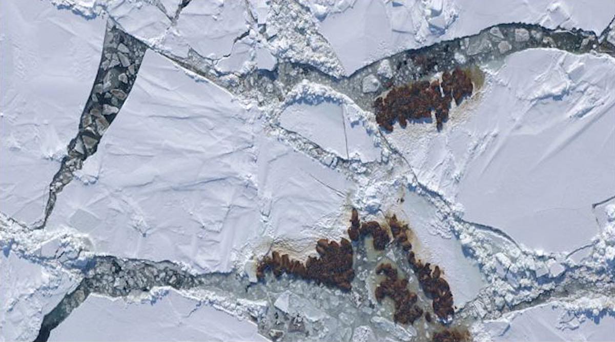
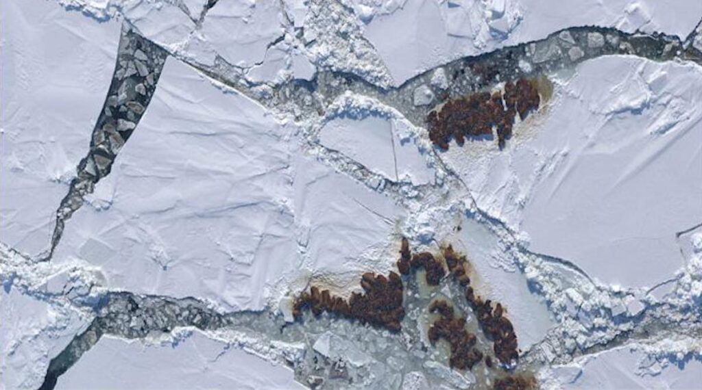
Scientists are appealing to the public to help them monitor the number of Walrus in the Arctic by looking at images—taken from space.
The real-life Where’s Wally? project will see animal-lovers scanning satellite images to help monitor Walrus populations along the Arctic coastline.
Conservationists hope that the ‘Walrus from Space’ research project will give a clearer picture of how each population is doing without disturbing the animals.
The project, led by the WWF and British Antarctic Survey, uses space satellites to capture thousands of high-resolution images of walrus congregated on more than 25,000 square kilometers (9653 square miles) of Arctic coastline—an area larger than Wales.
MORE: Study Reports Incredible New Numbers For Critically Endangered Grauer’s Gorilla Species
Anyone can take part in the walrus census using their own computer but they must undergo a short online training module before starting.
Rod Downie, chief polar adviser at WWF, said, “It’s easy to feel powerless in the face of the climate and nature emergency, but this project enables individuals to take action to understand a species threatened by the climate crisis, and to help to safeguard their future.
“What happens in the Arctic doesn’t stay there; the climate crisis is a global problem, bigger than any person, species or region.
LOOK: Amur Tigers Are Back From the Brink in China – Thanks to Government Policies
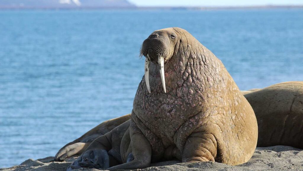
“Walrus are an iconic species of great cultural significance to the people of the Arctic, but climate change is melting their icy home.”
(WATCH the video…)
RAISE a Tusk For Citizen Science—Share This Story So Others Can Help…